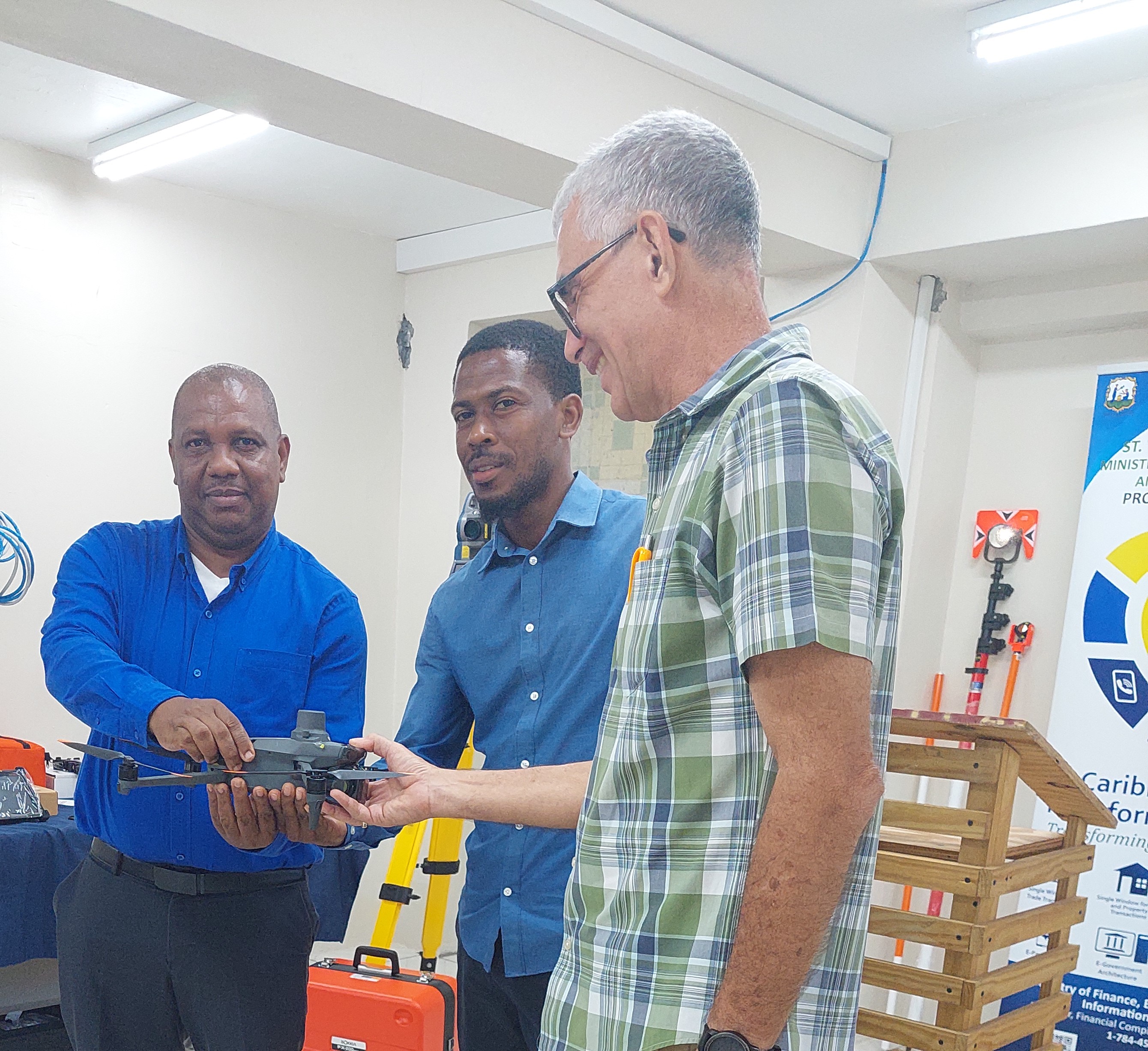
Chief Surveyor at the Lands & Surveys Department, Mr. Keith Francis, says that with the addition of a quantity of state-of-the-art equipment to the Lands & Surveys Department, Vincentians will soon see a significant improvement in the way things are done at that department.
Mr. Francis was speaking on Monday, February 5th, 2024, during a handing over ceremony at the Lands & Surveys Department at which equipment to the tune of US$137,924.46 was handed over to him from the Digital Transformation Project.
Addressing the ceremony, Mr. Francis indicated that a consultant will soon be here to advise the Department on how they can transform their existing data into data that can be used electronically, using the GPS equipment which he says is one part of the Geodetic transformation effort.
A critical part of the transformation process is updating the base map of St. Vincent and the Grenadines. Mr. Francis indicated that the latest imagery they have was done by aircraft in 2007 and this needs to be updated to reflect the changes over the years including the international airport, the new port, roads, housing, etc. He added that the Land and Surveys Department has newer imagery from 2014 but at a much-reduced resolution, and not suitable for use. “So, part of this project is that we are to obtain new imagery at higher resolution, and the result is that we are hoping to have each parcel mapped on the island. Some of them will be physically mapped and some digitized and issue a unique parcel identification number.” Mr. Francis noted that at some point they are going to have this data available through a web portal at a cost to businesses, valuators, banks, and other interested parties to be able to view and access.
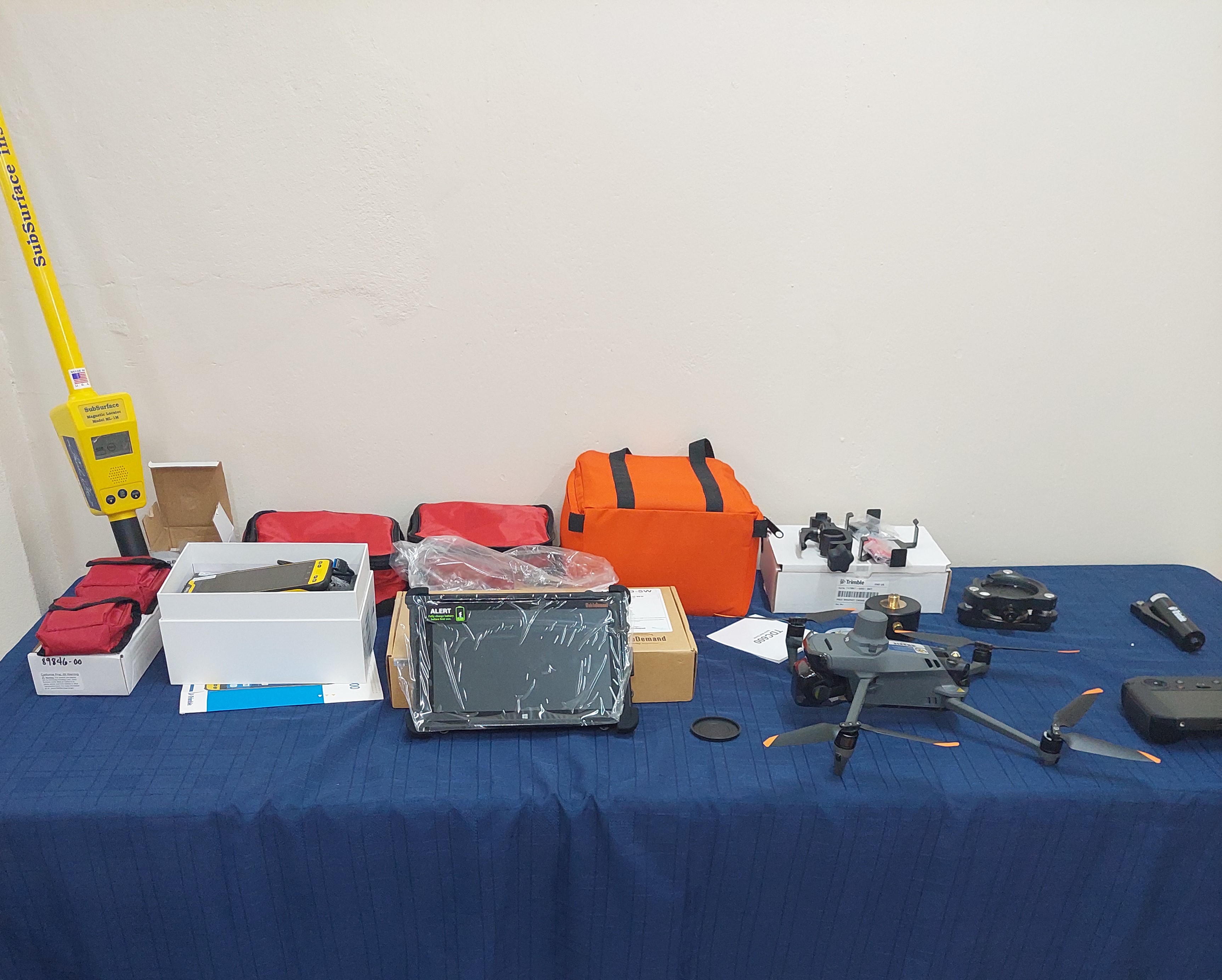
Meanwhile, Mr. Francis is assuring Vincentians that the equipment handed over to his department comes at a significant cost and will be used to the benefit of the nation. The equipment varies from the traditional, Total station, described as the bread & butter of surveying work, to drones, GPS units, GNSS Controller & Receiver, and Magnetic Locators, among others. He says all of this combined with the experience and qualification of the staff will result in tangible benefits to every Vincentian.
The Project Coordinator of the Digital Transformation Project, Mr. Winston George, also addressed the Handing-Over ceremony. He noted that the equipment purchased for the Land & Surveys Department is all in support of the establishment of an Electronic Single Window for Lands & Property Transactions. He says this will create a single space online in which citizens and businesses can easily transact land and property business with the Government of St. Vincent and the Grenadines.
According to Mr. George, utilizing this space would allow for the different public sector agencies responsible for land and property services to more efficiently serve citizens and businesses when buying or selling a piece of land or property. “So, to achieve this, the project has several components, one has to do with the digitization of the paper deeds in the Land Registry. The other item, we are doing a Geodetic Network survey and adjustment, aerial imagery of the entire country to provide the necessary base maps, and we are also looking at an integrated geospatial information framework or national spatial data infrastructure, which allows for the governance and sharing of spatial data.”
As it relates to the Cadastral Surveying component, Mr. George says, “we are establishing a parcel-based land information system and there are two things that go with it, (one) the digitization of the land records and (two) the Cadastral survey.” He urged the department to make the best use of the equipment for the development of the people of St. Vincent and the Grenadines.